MOGGERHANGER & CHALTON VILLAGE
WELCOME to the Moggerhanger and Chalton Village website. Here you will find lots to interest you about Moggerhanger and Chalton. We will regularly publish details about what’s happening and how to join in, as well as any special village news. We hope you find our new website easy and pleasant to use. More information and pages are being added as we expand this site so please be patient if everything is not available immediately.
Village Life: Moggerhanger has a strong community spirit. There are various groups and activities to bring people together socially and cater for various interests and activities.
WHAT’S ON & NEWS
Refuse Collections January 2026
Black Bins: Wed 7th and 21st
Recycling Bins: Wed 14; 17th, and 28th
Brown Food Bins: Every Wednesday.
Garden Waste: No collections until 25th February 2026
This service requires an annual license to be displayed on the green garden waste bin. Bins not displaying a valid license will not be collected. Please see the Central Beds website for full details.
Tidy Tips in Central Beds area: Open for Central Beds residents only.
From Wednesday 26 March 2025 you need to book before visiting any household waste recycling centre – More info from – https://www.centralbedfordshire.gov.uk/hwrc
School term time only unless stated otherwise>
More information from: 07905 281629 or our website
Moggerhanger Songs of Praise
Sunday 21st December at 6:00pm in St. John’s church..
Family Carol Service
Come along and join us to sing some favourite carols, and enjoy refreshments afterwards.
Everyone very welcome to this and all services.
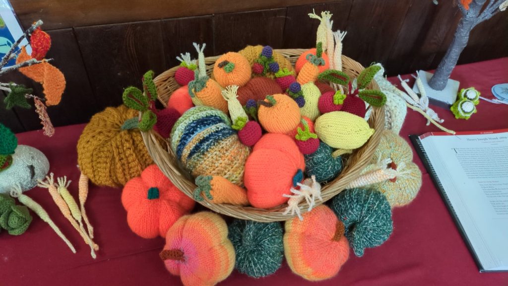
Knit & Natter

Anyone who likes Knitting (or Knattering) might like to join us as we meet in the church (St John’s) again on the 4th Thursday of the month 10:00 to 12:00.
Come with your own projects, with ideas for group projects or just keenness. We do have some wool in the church but best bring your own gear if you have it.
If you are completely new to knitting (surely not Knattering?) I am sure there will be people there who can start you off on your training wheels and give you a healthy push.
Interested but not available that day? Contact Ali Cross 640647
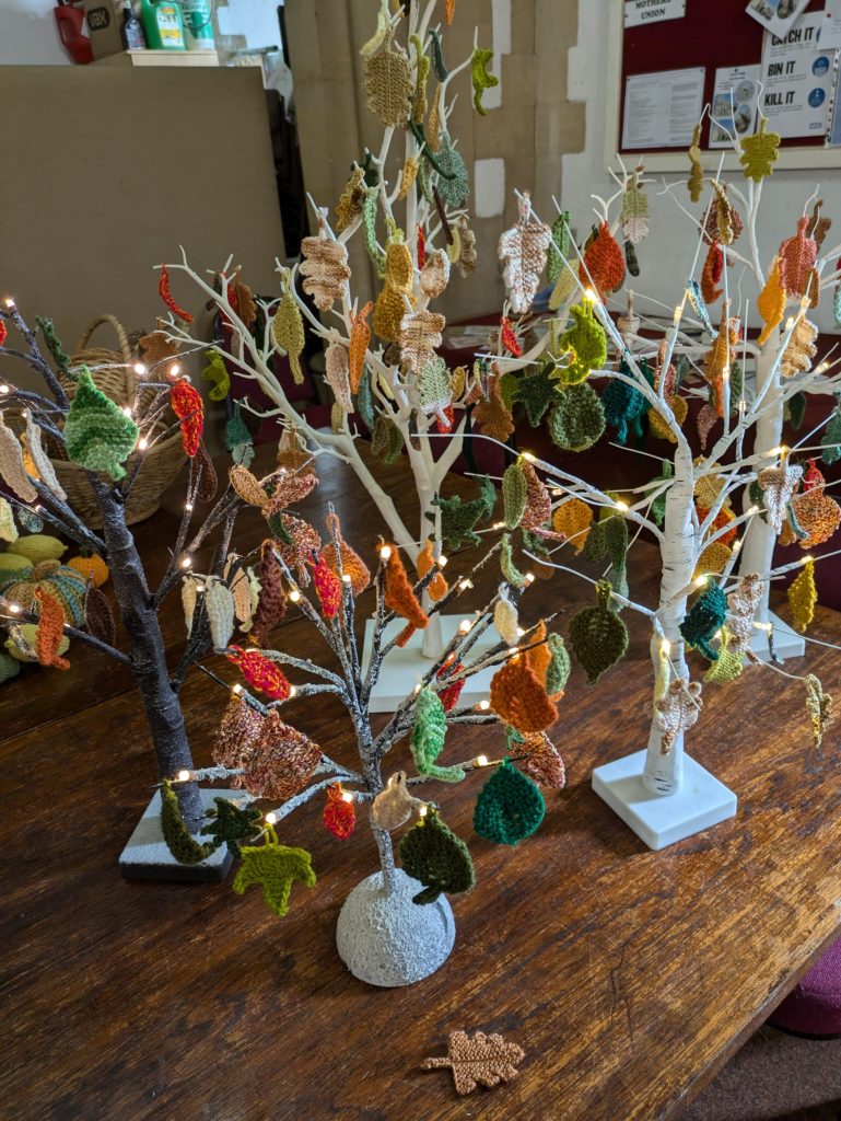
The amazing work of the Moggerhanger Knit n Knatter group. Decorating ready for harvest. If you love crafts join them every fourth Tuesday 10:00 at St John’s
Music Evening Wednesday 7th January 2026
CANCELLED DUE TO BAD WEATHER
We have a very popular regular MUSIC NIGHT on the first Wednesday of each month, doors open 7pm—music 7.30pm,
This is a FREE EVENT, very reasonable priced bar,
plenty of parking, raffle, local musicians singing and/or playing a variety of music — if you sing or play why not come along and join in, or just come and enjoy the music and great atmosphere – all welcome.
We advise you to get there early to make sure of a seat!!

Coffee Mornings in St. John’s Church
First Tuesday each month at 10:30. All welcome to join us for hot drinks and goodies.
The Benefice Choir of Cople, Moggerhanger and Willington.
Sadly we have not been able to find a Musical Director to take on working with the choir following the very well earned retirement of Shirley Jones as choir director. So, the services at Easter 2025 were the last opportunity for you to hear them sing.
BUT the choir are still keen to come together and sing on special occasions or services.
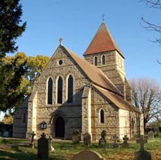
Friends of St John’s Church
The Friends of St John’s Church came into being in 2002. Its supporters are people who are not necessarily churchgoers, but who care about this beautiful little church in the centre of the village.
Funds are raised through membership and social activities.
Moggerhanger Meeting Place
People in the village may remember that there was a small shop in the church vestry until recent years, the brain child of the vicar Rev. Nick McNeil, who put the idea to the village in 1999. (It was apparently the first shop in a church in the country, made ecclesiastical news and started a trend.) He also proposed that the church should become a village meeting place, and so the venture was born.
The shop – which opened in June 2000 – was well used for several years, with a team of some 20 volunteers running it in the vestry on 6 mornings a week, who also kept it stocked up and provided tea and coffee at the back of the church. Then online shopping became more popular and in May 2018 the shop itself was closed and just the area at the back of the church was kept going as the Moggerhanger Meeting Place.
The Meeting Place continued to organise several social groups and raise money for charity. However, with the retirement of some committee members and the Covid outbreak attendances dwindled or events could not be held. At its AGM on 7th December it was agreed sadly to disband the organisation. A total of nearly £4000.00 was shared between the PCC and the Parish Council in accordance with the constitution.